
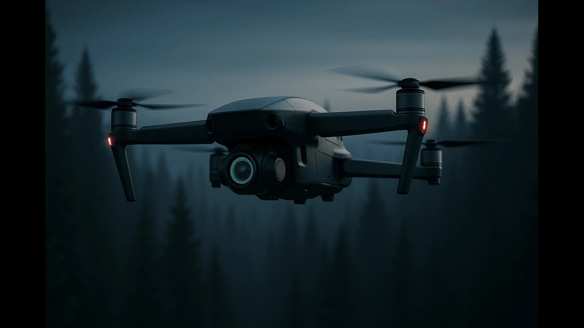
Autonomous drones are now navigating without GPS using AI, LiDAR, and neuromorphic sensors—reshaping defense, rescue, and industrial missions globally.
The development of autonomous drones capable of navigating without Global Positioning System (GPS) signals represents a groundbreaking advancement in unmanned aerial vehicle (UAV) technology. By integrating artificial intelligence (AI), advanced sensors, and innovative navigation algorithms, these drones can operate in GPS-denied environments, such as dense forests, urban areas, or contested military zones.
Several companies and research groups have made significant strides in this field, offering solutions that promise to transform military operations, search and rescue missions, infrastructure inspections, and more.
This article highlights five pioneering examples—University of Hong Kong’s MaRS LAB SUPER system, VECROS’s ATHERA platform, Advanced Navigation and MBDA’s NILEQ, Theseus (YC S24), and Blue Arrow (KEF Robotics and Sensorama Lab)—and explores their potential to revolutionize military.TS and civilian applications.
The Need for GPS-Independent Drones
Traditional drones depend on GPS for navigation, but this reliance falters in environments where signals are obstructed by dense foliage, buildings, or intentional jamming in electronic warfare (EW) scenarios. GPS-independent drones overcome these limitations by employing AI-driven systems, computer vision, LiDAR, neuromorphic cameras, and inertial navigation systems (INS). These technologies enable real-time mapping, obstacle avoidance, and precise navigation, making them critical for operations in challenging environments.
Breakthrough Innovations in GPS-Free Drone Navigation
University of Hong Kong’s MaRS LAB: The SUPER System
The Mechatronics and Robotic Systems (MaRS) LAB at the University of Hong Kong, led by Professor Fu Zhang, introduced the Safety-Assured High-Speed Aerial Robot (SUPER) in early 2025. This micro air vehicle (MAV) achieves speeds of over 20 meters per second (approximately 45 mph) while navigating GPS-denied environments like dense forests or urban settings. With a 280 mm wheelbase and a 1.5 kg takeoff weight, SUPER is lightweight yet agile.
SUPER utilizes a 3D LiDAR sensor for long-range obstacle detection, capable of identifying objects as thin as 2.5 mm, such as power lines or twigs, even in low-light conditions. Its dual-trajectory planning framework generates two flight paths: one prioritizing safety in known free spaces and another optimizing speed. This approach reduces collision risks by 35.9 times and halves planning time compared to traditional methods, as reported in Science Robotics on January 29, 2025. SUPER’s ability to navigate complex terrains at night makes it ideal for search and rescue, disaster relief, and military reconnaissance.
VECROS: Spatial AI-Powered ATHERA Platform
VECROS, an Indian deep-tech startup founded by IIT Delhi and NIT Nagpur alumni, has advanced GPS-independent navigation with its ATHERA platform. Launched in 2021 and gaining prominence through 2025, ATHERA integrates proprietary spatial AI, an eight-camera perception suite, and the Jetpix OS to enable autonomous navigation in GPS-denied environments like tunnels, factories, and urban areas. By June 2025, VECROS secured $570,000 (₹4.5 crore) in funding over six rounds from investors like Rebalance, OTP Ventures, and Aman Gupta, and holds 10 technology patents, contributing to the $166 billion global drone market projection by 2031.
ATHERA employs simultaneous localization and mapping (SLAM) to create real-time 3D maps, allowing drones to navigate obstacles and optimize flight paths autonomously. VECROS claims ATHERA enhances operational efficiency for industrial inspections, with case studies showing significant cost and time savings, though exact figures of 70% cost reduction and 60% flight time reduction await independent validation. The platform is conducting trials with the Indian Army through the iDEX program, focusing on autonomous mapping and defense applications in GPS-denied zones, positioning ATHERA as a leader in scalable drone solutions.
Advanced Navigation and MBDA: NILEQ System
Sydney-based Advanced Navigation and MBDA’s NILEQ subsidiary (Bristol, UK) signed a Memorandum of Understanding in November 2024 to develop a GPS-free navigation system, with a product release planned for mid-2025. NILEQ uses neuromorphic cameras, modeled after the human retina, to detect brightness changes across pixels, generating terrain fingerprints that are matched against a preloaded database derived from satellite imagery. This approach minimizes data processing and computational demands, making it suitable for low-cost drones.
Combined with Advanced Navigation’s fiber optic-based INS, the system ensures reliable positioning in GPS-denied environments. Flight trials are scheduled for 2025 in Australia, targeting applications in agriculture, defense, and commercial sectors. The technology’s resilience to interference and low power consumption make it a cost-effective alternative to traditional high-end navigation systems, which can cost hundreds of thousands of dollars.
Theseus (YC S24)
Theseus, a U.S. startup founded in 2024 by Ian Laffey and Sacha Levy, developed a GPS-independent navigation module during the El Segundo Defense Tech Hackathon in February 2024, with initial prototyping completed in approximately 24 hours. Using off-the-shelf algorithms, a 3D printer, and onboard cameras, their system compresses map data to fit 10,000+ square kilometers on a 256GB SD card. It compares real-time drone footage with this database to navigate without GPS, adapting to dynamic environments where structures may be destroyed.
Theseus has attracted attention from U.S. Army Special Operations for testing in military exercises and has held discussions with Ukrainian military representatives. The startup raised $500,000 in a pre-seed round, with additional funding commitments noted on one of the Social media platform, Theseus is refining its system for broader altitudes and speeds, aiming for applications in reconnaissance and defense by late 2025.
Blue Arrow (KEF Robotics and Sensorama Lab)
Blue Arrow, a joint venture between Pittsburgh’s KEF Robotics and Ukraine’s Sensorama Lab, is developing plug-and-play autonomous navigation for drones. Supported by a $50,000 Defense Innovation Unit award in April 2025, their system uses AI to navigate GPS-denied environments, with ongoing tests in Ukraine’s conflict zones. The technology focuses on precision strikes and reconnaissance, reducing risks to soldiers. Blue Arrow aims to deliver initial production units by September 2025, aligning with the U.S. fiscal year end, as confirmed by defense reports.
Applications in Military Operations
GPS-independent drones are transforming military capabilities, particularly in GPS-denied or jammed environments:
Reconnaissance and Intelligence Gathering: Systems like SUPER and Theseus enable covert intelligence collection in urban or forested areas, navigating obstacles with precision. Their ability to operate in low-visibility conditions enhances stealth operations.
Target Acquisition and Strike: Blue Arrow’s technology supports precision strikes in GPS-jammed zones. Ukraine’s VGI-9 targeting system, as reported by CSIS on March 6, 2025, enables FPV drones to lock onto moving targets at speeds up to 80 km/h, using secure PIN-coded targeting and real-time EW monitoring for precise strikes.
Swarm Operations: NILEQ and ATHERA’s scalable systems support drone swarms for coordinated mapping or attacks. The U.S. DoD’s Replicator program (January 2025) is exploring AI-driven swarms, which could leverage these technologies for overwhelming enemy defenses.
Resilience Against Electronic Warfare: Technologies like Blue Arrow and NILEQ counter EW tactics, such as jamming, seen in Ukraine and Russia. Ukraine’s procurement of 10,000 AI-enhanced drones in 2024, as noted by CSIS, reflects a shift toward autonomous systems, though this represents a fraction of the 2 million drones produced that year.
Civilian Applications
These innovations also have far-reaching civilian applications:
Search and Rescue: SUPER’s high-speed navigation in dense forests and ATHERA’s real-time mapping accelerate locating missing persons in disaster zones, improving response times.
Infrastructure Inspection: ATHERA and NILEQ’s cost-efficiency make them ideal for inspecting power lines, railways, and oil facilities in GPS-denied areas, supporting the $30 billion drone inspection market by 2026.
Environmental Monitoring: SUPER and Theseus systems enable nighttime and remote environmental surveys, aiding conservation and precision agriculture.
Urban Logistics and Delivery: ATHERA’s urban navigation capabilities support drone delivery, a market projected to reach $32.1 billion by 2031.
Challenges and Ethical Considerations
Developing GPS-independent navigation requires robust AI algorithms and extensive data training, as seen with VECROS’s scaling challenges. Military applications raise ethical concerns about autonomous weapons, prompting calls for UN regulations. Compliance with aviation regulations, such as FAA standards, is also critical for civilian use.
The AI-driven drone market is projected to reach $84 billion by 2030, fueled by advancements in machine learning and sensor fusion. MIT’s adaptive control systems (June 2025) aim to enhance drone resilience, while global adoption of GPS-independent technologies will require collaboration between innovators and regulators to ensure safe and ethical deployment.
From MaRS LAB’s SUPER to Theseus’s rapid innovation, GPS-independent drones are redefining autonomy in complex environments. These advancements, driven by VECROS, Advanced Navigation, MBDA, and Blue Arrow, promise to reshape military and civilian operations by 2030. Responsible development and governance will be key to unlocking their full potential.


